
Beech Saddle To Moss Ridge
22 k
We wake up in our perfect secret campspot and eat breakfast and pack, still sandfly-less. It’s easy to see how a person could get completely turned around in vegetation like this, you have to be practically standing on the trail to see it, but we chose and memorized a few unique trees and are standing on the trail in short order. 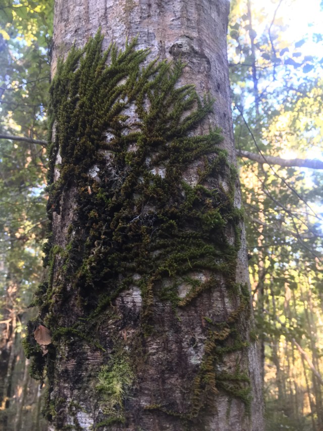
The trail leads us through another kilometer of pleasant forest and to a wide open meadow area, with tufts and hillocks of different grasses, and chunks of granite scattered about for decoration. This was our last resort spot to aim for last night since the map showed no trees, but the tussocks would be just as difficult to camp on as roots. 
Oddly, right before we step into the meadow, a little animal path in the Manuka catches Prana’s eye, and he follows it, and I follow him, to a perfectly cleared 20 foot across space in the trees. Who could have guessed?
It’s palpable from early on that it’s going to be hot again today, ‘a real cooker’ as I’ve heard it called over here. Hopefully there’s just as much amazing swimming on the docket; apparently my new favorite hiking activity, I realize with surprise. Also, hopefully swimming will help the new bane du jour, a spreading heat rash covering most of Prana’s back.
We reach the Browning Hut, a rather nondescript but perfectly adequate shelter. Inside is one man that we try to make small talk with, but who is uninterested in joining us in the effort. I mentally salute him at his ability to protect his solitude in what has now become such a public space.
Luke had mentioned there was a swimming hole here, but I am disappointed- looks like there needs to be some strict lines drawn between a swimming hole, a wading hole, and a sitting hole. Or perhaps, a wallowing hole? The sandflies are back in full force, and this is merely a sitting hole, so we give it a pass. However, now that we are trying to leave, we realize the only path we can see is the path we followed in. How do we get out? We finally find it on the other side of the building, winding away into the forest.
A few unmarked trails split off from the main track, and just to be playful, with great exaggeration I step over the huge pile of branches laid across one of them while chatting to Prana, and am rewarded with a duly bewildered expression.
As I drop into the valley that holds Hackett Creek, the track morphs into a huge mown swath through the grasses. Mown? How would you even get a mower up here? Maybe it was a perfectly trained regiment of goats. Or llamas. The Hackett Hut is also nondescript, other than the black, lab-ish dog that comes snarling out in a frenzy. “Oh, the dog’s nice!” calls a woman’s voice from inside the hut. “I don’t know if he knows that!!” calls back Prana. Thankfully she comes out and distracts the dog with a toy, and we learn that her husband is out hunting for the day. Before we can learn much more, the sheer density of bumblebees and ground hornets drives us away from the hut and onwards.
A large bridge spans Hackett Creek at the far end of the hut’s clearing, and as we cross I glance down and see a massively deep swimming hole below the bridge. Yes! This bodes well. This, and the sign that enumerates dire warnings about the difficulties to anticipate by leaving the maintained trails and embarking on the route behind the sign, The Richmond Alpine Route. Yes, please.
We cross Starveall Creek back and forth and back; it’s a gorgeous waterway, deeply shaded, deeply pooled, many short terraced cascades. 
We swim a few times, taking breaks from picking our way along the tree roots lacing the banks and along the carved boulders and over the shifting cobbles in the river itself. At the final crossing, before the trail leads for hours up and up a ridge to the next level of the Richmonds, is the best swimming hole of this section yet. We linger and swim and eat snacks.
Eventually we face the climb. It actually is not as steep as the elevation profile makes it out to be, but it is continuous. We pass through a few different areas of windfallen trees- why? What causes this? I can think of no answer that makes sense. I look forward to seeing Pyramid Rock- that will probably be unique, right? We pass by where it’s labeled on the map with no sign of any rock, pyramidal or otherwise, and reach a beautiful flat-enough spot for a comfortable snack break tucked into a graceful copse of beech trees. The heat! The climb! My body is drained of power. I watch the dappled sunspots swirl like confetti through the fluttering beech leaves, and the Fantails flit around us and softly cheep while I fill my gas tank with oaty bars. 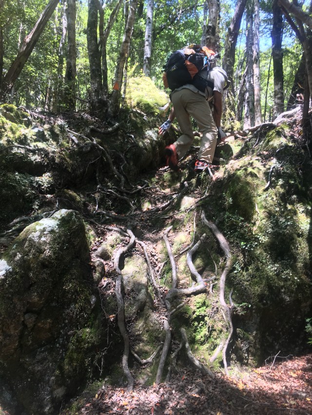
Passably revitalized, we continue the climb. Looking back, Prana notices a large rock face emerging out of the side of the ridge below us: the reason we couldn’t see Pyramid Rock when we were at it, is because we were essentially on the ridge concealing it. Hmm. It’s really hard to find good rocks in this country.
For some reason I had wanted to make it to Starveall Hut for lunch, but several kilometers short and several hundred meters below, I run out of fuel again. I also can’t seem to get enough water into my system to slake the thirst my brain is certain I have, but I can’t be thirsty; I’m peeing constantly. I conclude it must be so hot, my brain has no other coping strategy in its arsenal. We find a beautiful creek to have lunch next to, and while I am processing lunch rations into leg-diesel, I notice that there are hardly any bird sounds. The bird symphony was so ubiquitous on the North Island, and present enough on the Queen Charlotte Track, that I hadn’t noticed until now that the birds are essentially missing on this island. Perhaps just here? I hope- the sound is one of my favorite things about this country.
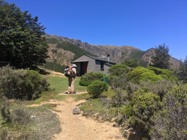
We finally make it to Starveall Hut around 3:00, a small shelter with fantastic views, a small rain barrel, and a massive hiker yard sale in front, with a body napping face down in the middle of the explosion of gear. Prana and I take a 20 minute break and refill our water; from here on for awhile, all of our water will only come from huts, as we are on the crest of the mountains and all streams coalesce below us. I debate how much water my overheating systems will demand until the next hut in 4 hours, then tackle the last bit of Mt Starveall itself. 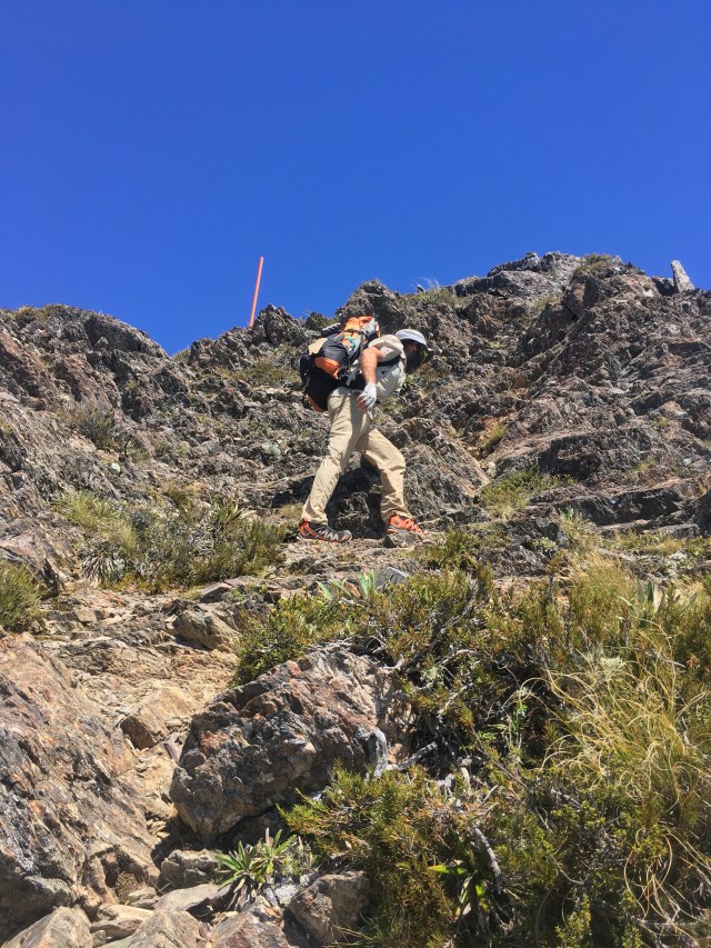
As soon as we leave the hut, we are climbing on rock. Some big rock chunks, using our hands, some long stretches of talus. At last! And now that we are out of the trees, the wind is gigantic, insistent. It is a miracle cooling force, hollering at me in a friendly way: not to worry!! you will have enough water!!
There is a woman walking down towards us carrying a radio and a can of orange paint, a Dept of Conservation worker brightening up the poles that mark the route we will follow. We chat with her briefly about the weather before carrying on to the top.
Mt Starveall is a rounded, gentle summit, and the views are incredible. We can see back to the Golden Bay coast and the Abel Tasman Track, and I try to imagine which spot this was on the Richmond silhouette we could espy from the Abel T.
We drop from the open views into stunning, clean, mossy beech forest, tracing a ridge that will bring us back up to Slaty Peak and around the backside. 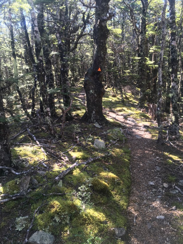
The beech gives way again to tussock and views, and in little time we are at the Slaty Hut and ready for dinner. We cook a big pot of couscous, miso soup, and dried shitaake mushrooms at the picnic table outside of the hut, in the pleasant evening air. The couple inside comes out to join us; they are from the UK and over here on true holiday from their work holiday in Australia where they coach orienteering as a competitive sport. They assure us we will be able to find camping on the ridge ahead, where we predict on our maps, and also clue us in to an unmarked water barrel. “It’s on the ridge just before the Old Man Summit,” they explain. It’s just an open barrel, no catchment, but there were probably 15 gallons when we went by today.” This is great news, since we would either need to carry enough water to last through the heat until the following day, or spend an hour detouring down to a lower hut that we hadn’t planned to visit. 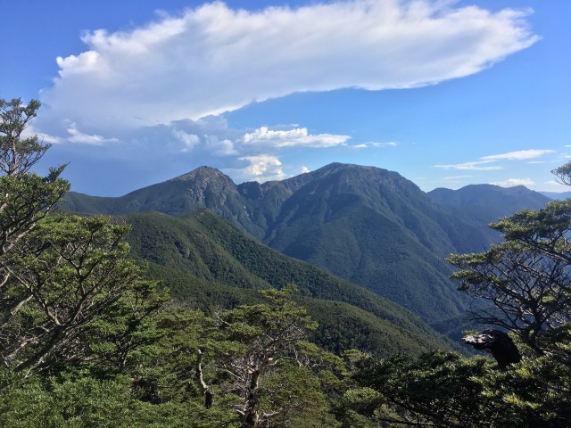
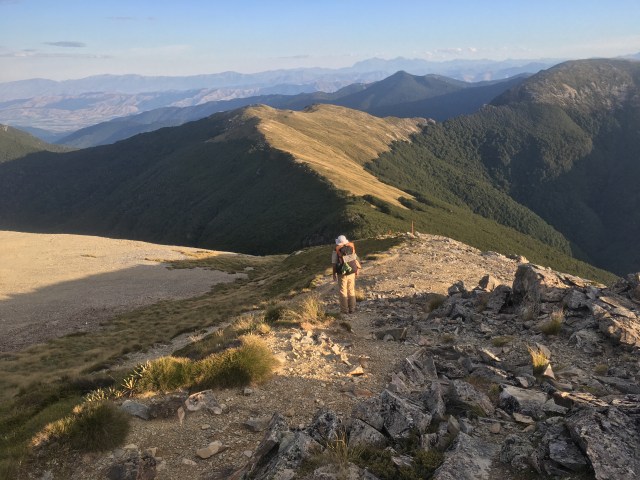
We leave after dinner, in the lengthening evening light, and the trail leads us around the inside of the scree bowl below Slaty Peak. We meet a Dept of Conservation worker returning to the hut after a relished day’s work of goat hunting (they’re considered nuisances here). Finally, this guy is the first person that doesn’t seem appalled/concerned that we are leaving a perfectly good hut this late in the day. I send a wish to the universe to be reincarnated as a DoC worker next time around. 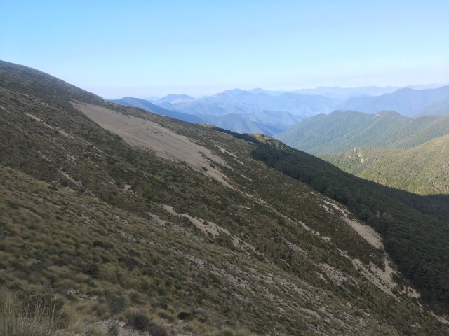
The scree is some kind of shaly rock that slides around and pings against itself with happy musical sounds. Stripes of tussocks slice through the debris fans, and we work our way back up onto an unnamed ridge with unending views. Everything is warm golden and rosy tones in the late light. 

We cross more musical shale and descend onto a forested ridge a bit past 8:00. We pass by a suitable camp at the beginning, holding out for one at the far end, hoping to gain another half a kilometer tonight in the gamble. We drop much more elevation than I realized I was anteing, and before the trees and their protection, thin out completely, we find flat spot big enough for the tent. A spot which is pure rock beneath the moss, meaning the stakes won’t go in.
The idea of backtracking seems absolutely dismaying now that I am faced with it, but there is nothing to be done. I try to remember how far back the last spot was, when suddenly, like one of those optical dots pictures, a tent-sized flat space appears on the trail. “How about this?” I call to Prana. “I’ll take the door that is trapped against the tree.” He agrees, and we have the tent up and are inside in no time. I breathe a sigh of relief, the dark descending, and fall asleep making notes from the day.
