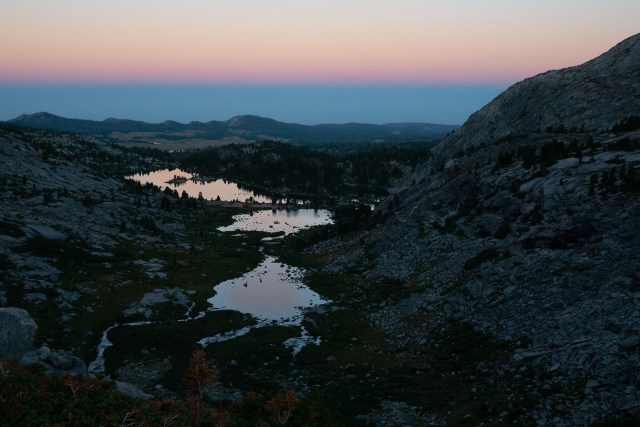
Bonneville Basin felt like a wild place to wake up in, the belt of Venus glowing pink above the island-speckled lower lakes. The chivalrous Prana dug a double cathole, and we were off.
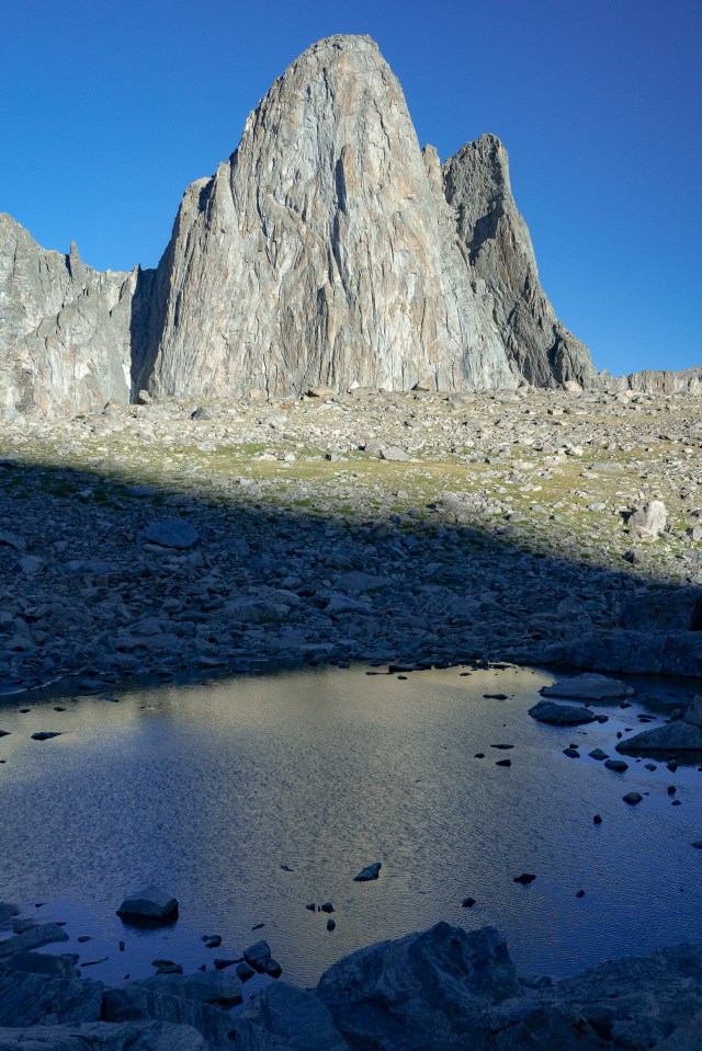
Circumnavigating the lake went much more quickly than I’d imagined, the parts that looked tricky from a distance yielding easy up close. The only camps we passed were desperate burrows in the krumholz, endorsing our decision to stay put last night. Sentry Pass was made of blocks stacked in tundra, steep but straight forward, the boulders featuring the most artistic swirls yet, monochromatic abstract bursts. Pronghorn Peak speared the sky, illuminated by rosy spotlight as we gained the saddle.
We descended the long “grassy” ridge, loose dirt and rocky, and painstakingly dropped down to Lee Lake. How high should we stay to miss the willows? we debated. We wended along, dropping, climbing, stringing together little open pockets and lines of less resistance. One pocket of car sized-boulders threatened to drop us into the middle of an impenetrable willow ring, but miraculously we squeezed down and around one boulder that concealed a hallway to freedom.
Once we were sitting on the open shore of Lee Lake, I went for my second dig of the day, then filled myself with snacks. Finally, some appetite to work with. The warm sun, lack of wind, pleasant air, blue sky…it was enough to lull one to stay.
We worked our way onward, crossing the big mushy expanse between Lee and Middle Fork Lakes, and started our intermittent willow whack around Middle Fork Lake. Elk Trails appeared and disappeared, opened and closed around us as we pushed our way along, beckoning and then vanishing. At the base of the climb to Brewster Lake, we considered our options. A thin line of willow-less tundra shot straight up the 60 degree slope beside the waterfall outlet, or large disconnected swatches of bare tundra patchworked with willows out to the right. We chose the outlet, but somehow were shunted by the forest to end up far, far right. Prana used the force, followed his instincts, and somehow led us to the lip of the hanging valley with exactly zero bushwhacking.
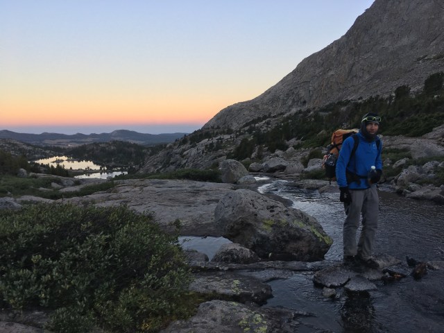
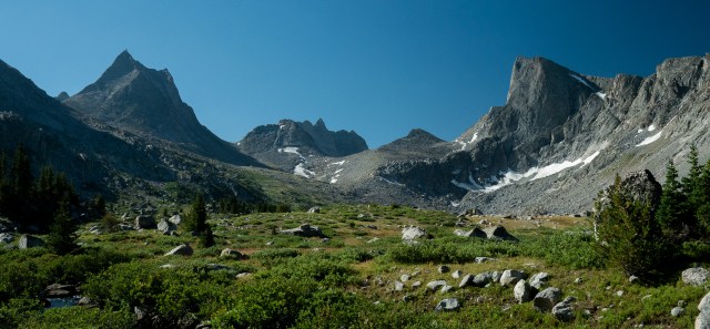
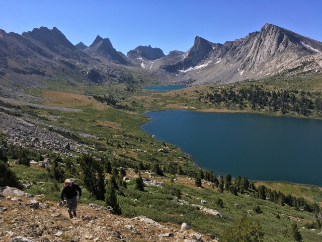
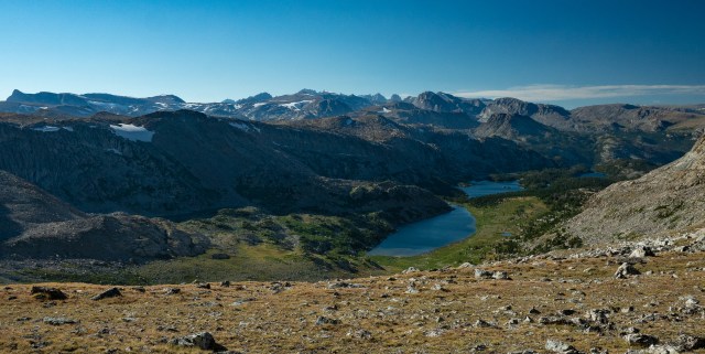
Bewmark Lake stretched before us, ringed by open tundra, cupped by steep ridges, the prismatic Photo Pass centered over the far end. Behind us, the upper valley cradling Sentry and Pronghorn Peaks stood proud and awe-inspiring. As we traced the shoreline, a random guy dressed in heavy canvas cargo pants and no gear stepped into view, noticed us, and furtively stepped back behind a boulder. Where did he come from? “I got a strange vibe,” Prana whispered, and the hair stood up on the back of my neck. We hightailed it around the lake until the first swell of land blocked us from view.
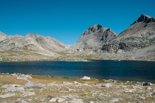
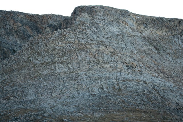
Bands of minerals striped Photo Pass with pastel pinks and pale turquoise. A well-packed trail offered fast time across the tundra, and a legitimate trail wound steeply to the top.
The descent of the backside of Photo Pass also featured a trail, but the slope was so steep it perhaps would have been easier without one. One barely-controlled slide in dirt and scree to the next, we worked our way down, down down down down…until the trail disappeared, leaving us precariously perched in barely settled talus. Slower now, still down, we finally gained the grassy meadow that marked the end of the plummet. Holy shit.
We strung together cairns until we both stopped, practically mid-stride, out of juice like wind-up toys, next to the unnamed spear of a lake, for lunch. We re-sorted our maps as we shoveled down couscous, the sun enveloping us in soothing warmth. We set an alarm to make sure too much time didn’t evaporate, then hit the snooze…then hit snooze again. It was so hard to take a short lunch.
We continued on heaved tundra, following intermittent elk trails, piles of their pellets and outlines of their hooves everywhere, to what the map notes designated a “navigational challenge.” At the South Fork of Bull Creek we found a hop across to keep our feet dry, no problem, and headed into the forest.
Initially the outline of a faint track was visible, with the remains of cairns intermittent in the underbrush. As we pushed into the thick of it, a low rumble sounded. I looked up in time to see a few light colored butts flashing through the trees – we’d spooked up a heard of elk.
Prana talked aloud his plan for navigating, pointing out a saddle and cliffline to use as a handrail. I nodded, but as we veered farther and farther from the cliffline, I realized my misunderstanding and that we were aiming to the right of the cliff. In a meadow any trace of the path again disappeared, we started up the cascading creek. The overgrowth was thick, the tumbled boulders choking the way forward in the courseway. After we’d struggled a good bit, Prana realized the pitch of the slope was steeper than it ought to be, and it also, according to the map, ought to be forested. We checked against the GPS, and realized we’d somehow started up the wrong drainage. “Well,” said Prana, “no problem, we can bushwhack along the contour, ours is just the next one over.”
We pushed into the tangled forest, splitting the difference between following the contour and gaining elevation we needed to anyway if that was the line of least resistance. Surprised when we still hadn’t reached the creek after 20 minutes, we checked the GPS again… no closer! Somehow the topography was herding us upward and paralell to the original creek, as if the topography was shifting around us. We bore more aggressively across, checked the GPS again; better but still not progressing as east as it felt. We checked the GPS every few minutes, correcting bit by bit, and found ourselves standing in a dry meadow. Where was the creek?
We followed the grassy depression uphill, still confirming on our GPSs, and finally located the first tarn, or rather, the hole where it used to be. From there we navigated uphill again, found our second tarn, ringed by lovely rock walls, and then, after a brief spat about whether we should continue or not, we reached the third tarn, and our marker for heading “against the grain” in attempt of reaching Europe Peak.
We ‘acrossed the grain’ as predicted, and again found ourselves confounded by a devious topography. We were too far left, and worked hard to make our way back to the right. When confronted with a lake that seemed too good to be true to have reached already, we checked the GPS and found ourselves still too far left; below a different hanging lake. Prana took off, a method mapped in his mind, and I started to get irritable with the fact that I also had opinions about how to get back on track, but being the slower mover, was at the mercy of following. We ended up scrabbling on some steeper ramps, circling around to a point we had passed earlier, at last below the obvious wall that ought to have been our reference point all along, which we had somehow talked ourselves into discounting. We strolled up the flat shale tiles flooring a shallow outlet stream, and clambered around the lake to its inlet, which we walked right up the middle of – unexpectedly spectacular. The water tumbled musically through the boulders, and joy blossomed, as I was reminded of several of my favorite creek-scrambling sections on the Te Araroa. Close to the lip of the cascade, Prana asked, “should we just get water here? At least we’re semi-protected from the wind.” I agreed. “Let’s take a page from Tristan’s book while we’re here,” he said. “What?” “You know…afternoon latte!” I laughed. “Sounds perfect.” As we set up the water filter, I dug out some snacks, and, as I basically inhaled my portion in one breath, realized I was feeling pretty close to normal again.
We topped the waterfall, and worked up steep tundra. I was still a bit puzzled where Europe Peak exactly was – I had gotten so turned around in the lower topography. The tundra faded to a gravel saddle, and we crunched up the incline, finally gaining more or less the divine itself, and the first look at Europe Peak.
“Whoa.” I said. “That?”
Most accounts I’d read all warned more or less the same: it looks a heck of a lot worse than it is. I knew this; and again, comparing it to everything else’s reality vs appearance so far, assumed the distance must be flattening the perspective of the ledges, especially in the long evening backlight. “Huh.”
A broad, rounded ridge curled towards it. We walked the wide tundra highway, with views opening down into the Milky Lakes valley, the humped ridge of the Divide visible to the north. We passed a tiny tarn. As we drew closer, I started calculating the day light we had left. If the “Class 3 scramble to knife-edge ridge Yeehaw!” line became perfectly obvious, we would have enough light for the ascent- an hour remained at this point. Then there would be 1.5 possibly inobvious miles on the divide itself – anywhere from 45-90 minutes. And, though it was a spur rather than inline, the summit proper of Europe Peak was technically on the route- another 30 minutes minimum. Darkness would catch us, no doubt. No rock outcroppings were apparent from our vantage- no protected camping if the wind was blowing from the west up there.
“What do you think?” asked Prana.
I sighed. Grappling with myself as always. “Well. I’m wondering if camping on the Divide would be miserable.”
“It might be,” said Prana.
“I hate feeling like we’re stopping early, but I think it would be way more fun to do it in the morning.”
“Yeah, I was wondering that too.”
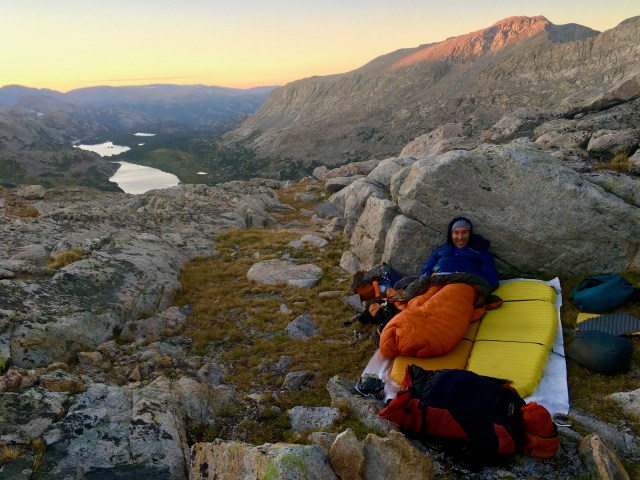
We found a little cowboy camp tucked between two parallel spines of the cross-grain, mostly concealed from the wind. We’d minimized our water carry, and so I offered to go back to the tarn. I picked up the empty water bladder, and as I stepped lightly, packless, I realized how poorly I’d done so far on this trip for paying attention, for noticing the precise details of my particular passage. None of the rock forms looked familiar as I back-traced my way to the water.
The edge of the tarn was soft, grainy mud with prints sunken into it. I’d seen no prints as we crossed the huge rounded ridge, but here were hoof prints I assumed were elk, smaller ones that may be deer, outlines of perhaps a coyote’s paws, and pressings of other human’s feet, all mixed and overlapping. I smiled; drawn to the only watering hole up here, we humans aren’t so different from other animals after all.
Back at our little bivvy we cooked dinner and I put the long lens on my camera, taking closeups of Europe’s face and enlarging them further, hunting for our line. I guess we’d just have to find it on our way in the morning. The Milky Lakes basin goldened then slipped into shadow below, light growing long and twilight gently striping the sky. The wind lulled; the immense silence hummed. I lay on my back, watching the stars appear like raindrops on dusty ground, then rain, then the whole sky was flooded, gushing with starlight.