I could have slept hours more, but by whatever twist of irony, this despiser-of-waking was the one who usually heard the alarm in the morning. To maximize the day, we decided to save breakfast for lunch; all of our breakfasts except the first needed cooked- one of the compromises in weight and volume that allowed 8.5 days of food to be crammed into our food bags- but, as we were learning, morning was the most valuable hiking weather and we couldn’t justify the cooking time. “To do this route as a thru-hike, you have to really want it,” we’d read somewhere. And I really, really wanted it. Wanted it enough to drink icy cold, poorly-dissolved, gritty instant coffee every morning.
I slurped/chewed my coffee as the alpenglow bloomed on the Towers. Despite the rosy lighting, my thoughts circled blackly. My ankle was no better, and it usually revived magically overnight. I felt hungover and nauseous from my lack of self-care yesterday. One of my knees ached when I bent it, I guess from being comatose in one position all night. And our next pass, New York pass, scared the shit out of me as I looked at it. If yesterday used 100%, and I was starting today at 40%, and today was a longer day…what if I couldn’t do it? What if I was the weak link that kept Prana from doing it?
Prana inquired about my silence, and I confided my fears.
“Well, we’ll just take it as it comes,” he said. “Finishing is a great goal, a fun goal, but even more importantly, this is time we set aside to be together, out here, enjoying the mountains and each other.”
Tears prickled my eyes. How did I get so lucky?
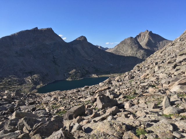
I choked down snacks as we descended to Lonesome Lake. The Cirque, or rather the hollow it encircled, was so much bigger than I’d imagined. There was space to explore within it for days. We filtered and drank and filtered more water, making a pact to drink regularly today, even if stopping to filter frequently slowed down our mileage.
“We could go over Texas Pass, if you think that would be better,” offered Prana. The guide listed Texas as “easier, longer, and less topographically or technically interesting than New York,” New York apparently “interesting” enough it was the one other hand drawn line on our maps; you know, other than the West Gully.
I thought about this, weighing my conflictions. “Well, let’s start with New York. Maybe it will look better if we get a little closer.”
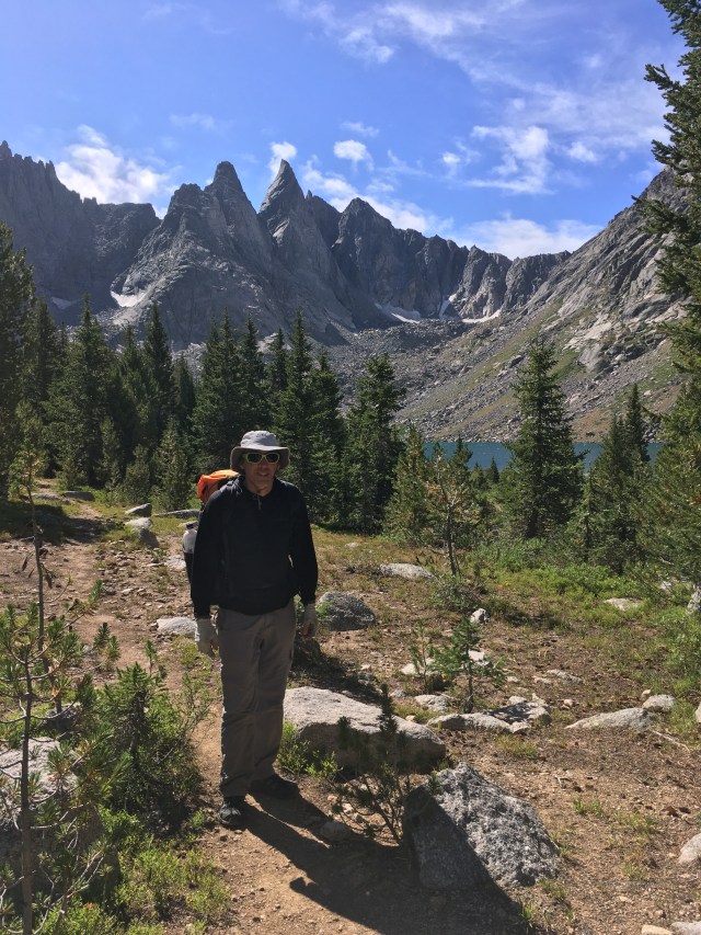
Up steep trail from Lonesome Lake, we spiraled around Pingora Peak, indisputable centerpiece of the Cirque. A monolith jutting into the center of the ring, she was hewed by glaciers draped back to back across the eastern ridge of the Wolf’s Head. A Shoshone name meaning “high, rocky, inaccessibile peak,” Pingora seemed to magnetize sunbeams towards herself, basking in the spotlight. A slightly inaccurate name, I thought to myself, as most of the climbing shouts in the basin echoed from her flanks, and teams of climbers were queued at her base.
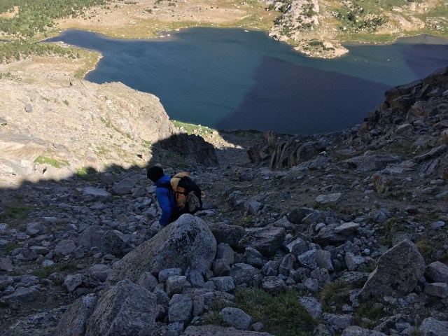
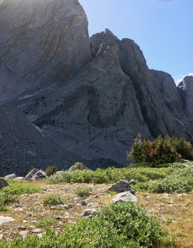
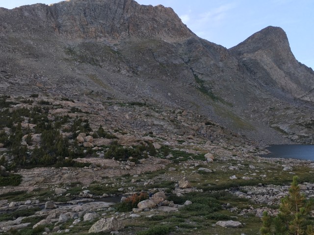
I was struggling, and loathing myself for struggling. Even on trail, albeit steep trail, I stopped to heave for air; I just couldn’t keep my puff. New York Pass looked no better yet: steeper than West Gully, super loose, overhung with a cornice. Wait and see, became my mantra.
When I caught up to Prana, he was scrutinizing the map against the land. “I’m pretty sure those ledges to the right of the actual pass are what we’re headed for.”
I looked where he pointed. The ramps were blatantly prominent, just so much farther right than I’d imagined from the verbal description, I hadn’t considered them. “Those look pretty doable, really,” I said.
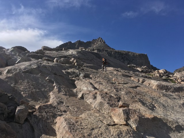
Scrabbling up talus to reach the ramps, we found them covered with loose scree and dirt. I kept thinking it would transition to something more consolidated, but each step resettled or skidded; the crux 8 steps crossed a gravel- and dirt- sprinkled bedrock chute, sloping aggressively to the edge below. No grassy ledge buffer on this one. Full concentration on each step delivered both of us on a wider, friendlier ledge, a sidewalk to the pass proper, where we stepped into a galing wind.
“That worked pretty well!” I yelled over the roar. “I’m glad we didn’t have to come straight up!” Straight up is the route which had filled me with dread this morning, and peering down into the main chute’s precarious rubble, it looked straight up miserable. Our next objective was to find “the middle gully” on the backside, our way down, which I could only trust would be apparent when we saw it. We hunched behind a rock to pull on some layers, then started down the tundra on the backside of the pass.
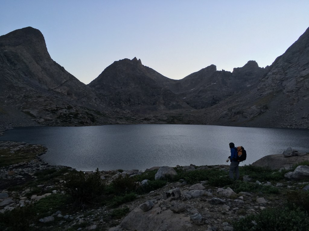
The tundra did indeed give way to three distinct scallops, and the descent was the easiest of all the difficult things so far. We filtered water from the lake at the bottom, giddy with success and scenery, amazed to find the backside of the Cirque of the Towers just as arresting as its front.
We intersected excellent trail, perfectly manicured, and zoomed through open valley views speckled with lovely forest. The Hailey Pass Trail turned off and upwards, through broken and burned trees, snaking to Skull Lake, exit marker for our next cross country excursion. We were to cross through forest checkered with small open meadows, and Prana made a map and compass game for himself, leading us from park to park, reorienting and triangulating for each segment. On one such consultation, he had the map skewed off kilter, at least to my eyes.
“I think something’s off,” I said.
As he lifted the compass and aligned map off the rock he was using as a table to see if it was uneven, the needle slowly swung 100 degrees. “What the?” He’s lowered it and the needle slowly swung back. “I guess this rock’s magnetic!”
He was crowned official winner of his game when we popped out at the exact spot he’d been aiming for along the bank of the East Fork River. We willow-whacked upstream onto open granite slabs for lunch. Peaks and pinnacles paraded an unbroken western wall of the valley, and the river pooled and pillowed in tiny waterfalls over the slabs. Prana cooked up the grits and I went to wash the grime out of our socks as a possessed wind raked the valley. Carefully keeping the socks trapped under one calf , I still was one short when they were all scrubbed and wrung. Dang it! I searched, then more frantically. Prana joined in, and he tracked it to where it had hung up in some branches downstream.
I could have spent all day at that spot, watching the clouds and peaks. But, onward. The wind doubled down, one fierce gust ripping in half the paper map Prana held spread.
On up the drainage, we scampered up granite slabs through open forest as the overhanging walls supervised from the left, crossed a huge and empty gravel field, climbed a monstrous terminal moraine, and then walked the top of a monstrous lateral moraine for quite a long time. This valley was at least as spectacular as the Cirque- how had I never heard of it? Or maybe I had, and it’s name just didn’t lend itself to remembering. The crazy wind continued: in one lake (below a ‘usable’ pass- our new favorite game was ‘would you use that pass?’) the wind blew huge sheets of spray off the surface, dashing them against the rock. The crazy walls and peaks continued: in one massive face, a darker band of bedrock was accordioned into a squiggle. What was going on in the core when that wall was getting re-forged down there?
We gained the head of the valley, the access to Raid Peak Pass – a 2 for 1 deal which required a semi-contour around Mt Bonneville. We scrambled up easy slabs, then boulder hopped to the top of the first pass into the full force of the wind. We hopped down and around, passing a perfect reflecting tarn before gaining the shoulder which would allow us into the upper Bonneville Basin, assuming we could find the Class 3 scramble down- a map notation I’d been too exhausted today to spend my normal amount of time agonizing about. When the talus gave way to bedrock ramps, we debated which might offer the best descent. I passionately defended the exact location of the map’s datapoint, and, letting me have my turn, Prana followed. The route we found was beautifully simple – only 1, perhaps 2 moves, rate-able as Class 3; looking back up from the bottom, it would be hard to guess where that exact weakness lie, and many other slabs similar at the top did not end in a comparably easy landing. Hats off to the map’s precision.
Camp. We’d scoped the valley from above and seen nothing obvious. As much as we both wanted to get ahead of our itinerary- knowing all along tomorrow’s apportionment was optimistic bordering on fanciful- I was exhausted, and we wouldn’t make it over our next pass before dark. We each scouted different directions, and Prana called he had found something, a tiny clearing in the krummholz against the upper cliff, sheltered from the wind. “It’s too small for the tent, but the weather looks fine enough to cowboy camp.”
The site overlooked the lower Bonneville Lakes as they reflected the evening’s colors. Stars winked on behind Mt Bonneville and Raid Peak, and we snuggled down into our quilts as the Milky Way began to flicker.